
Category:Images from Geographicus
This file was provided to Wikimedia Commons by Geographicus Rare Antique Maps, a specialist dealer in rare maps and other cartography of the 15th, 16th, 17th, 18th and 19th centuries, as part of a cooperation project.
|
Wikimedia category | |||||
| Upload media | |||||
| Instance of | |||||
|---|---|---|---|---|---|
| Category combines topics | |||||
| Geographicus Rare Antique Maps | |||||
company specialized in antique maps | |||||
| Instance of | |||||
| Industry |
| ||||
| Named after |
| ||||
| Location |
| ||||
| Item operated |
| ||||
| Owned by |
| ||||
| Headquarters location |
| ||||
| Founded by |
| ||||
| Inception |
| ||||
| official website | |||||
| |||||
| Statistics |
| |
| files so far! |
Ce fichier a été fourni à Wikimedia Commons par Geographicus Rare Antique Maps, marchand spécialisé de cartes rares et de cartes historiques des 15e, 16e, 17, 18e et 19e siècles, dans le cadre d’un projet de coopération.
Subcategories
This category has only the following subcategory.
Media in category "Images from Geographicus"
The following 200 files are in this category, out of 2,382 total.
(previous page) (next page)-

-

-

-

-

-
-

-

-

-
 1874 Gray Map of Baltimore, Maryland - Geographicus - Baltimore-gray-1874.jpg 3,500 × 2,812; 3.54 MB
-
 1874 Gray Map of North Carolina - Geographicus - NorthCarolina-gray-1874.jpg 3,500 × 2,651; 3.03 MB
-
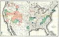
 1874 Johnson Map of Missouri and Kansas - Geographicus - MIKA2-johnson-1864.jpg 5,000 × 3,808; 7.59 MB
-
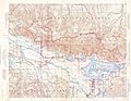
 1874 Ludlow and Custer Map of The Black Hills - Geographicus - BlackHills-custer-1874.jpg 4,000 × 4,764; 2.78 MB
-
-
 1874 Mitchell Map of Florida w- Mobile, Alabama inset - Geographicus - FL-m-1874.jpg 3,000 × 2,386; 2.34 MB
-
 1874 Mitchell Map of Iowa and Missouri - Geographicus - IOMS-m-1874.jpg 2,493 × 3,000; 2.54 MB
-

-
 1874 Mitchell Map of North America ^ the United States - Geographicus - AmerNorth-m-1874.jpg 2,390 × 3,000; 2.52 MB
-
 1874 Mitchell Map of Ontario, Canada - Geographicus - Ontario-m-1874.jpg 3,000 × 2,384; 2.27 MB
-
 1874 Mitchell Map of Pennsylvania - Geographicus - PA-m-1874.jpg 3,000 × 2,440; 2.58 MB
-
 1874 Mitchell Map of Quebec, Canada - Geographicus - Quebec-m-1874.jpg 3,000 × 2,391; 2.24 MB
-
 1874 Mitchell Map of Russia - Geographicus - Russia-m-1874.jpg 3,000 × 2,360; 2.5 MB
-

-
 1874 Mitchell Map of Vermont and New Hampshire - Geographicus - VTNH-m-1874.jpg 2,454 × 3,000; 2.32 MB
-
_-_Geographicus_-_NewYork-uscs-1874.jpg/120px-1874_U.S._Coast_Survey_Map_of_New_York_City%2C_Bay_and_Harbor_(2_part)_-_Geographicus_-_NewYork-uscs-1874.jpg)
-
 1874 U.S. Coast Survey Map of the Mississippi Delta - Geographicus - MissDelta-uscs-1874.jpg 6,000 × 7,325; 7.31 MB
-

-
_-_Geographicus_-_SavannahCarleston-uscs-1874.jpg/120px-1874_U.S._Coast_Survey_Map_or_Chart_of_the_Georgia_and_Carolina_Coast_(_Charleston_and_Savannah)_-_Geographicus_-_SavannahCarleston-uscs-1874.jpg)
-
_-_Geographicus_-_LakeChamplain2-uscs-1874.jpg/120px-1874_U.S.C.S._Map_or_Chart_of_Lake_Champlain_(_Burlington%2C_VT_)_-_Geographicus_-_LakeChamplain2-uscs-1874.jpg)
-
 1875 Gray Map of Washington and Oregon - Geographicus - WashingtonOregon-gray-1875.jpg 2,815 × 3,500; 3.4 MB
-
 1875 Meiji 8 Japanese Map of the World - Geographicus - World-meiji8-1875.jpg 6,000 × 4,589; 8.97 MB
-
 1875 Meiji 8 Japanese Wall Map of Japan - Geographicus - Japan-meiji8-1875.jpg 6,000 × 6,601; 7.35 MB
-

-
 1876 Colton Railroad Pocket Map of New York State - Geographicus - NewYorkPM-colton-1876.jpg 5,000 × 4,319; 7.48 MB
-
%2C_China_-_Geographicus_-_Taiwan-imray-1876.jpg/120px-1876_Imray_Blue-back_Nautical_Chart_or_Map_of_Taiwan_(Formosa)%2C_China_-_Geographicus_-_Taiwan-imray-1876.jpg)
-

-
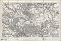
 1876 Stieler's Map of Southeastern Australia - Geographicus - AustraliaEast-s-76.jpg 3,389 × 4,000; 3.87 MB
-
 1877 Mitchell Map of Arizona and New Mexico - Geographicus - AZNM-mitchell-1877.jpg 4,000 × 3,237; 3.33 MB
-

-
 1877 Mitchell Map of Vermont and New Hampshire - Geographicus - VTNH-mitchell-1877.jpg 2,701 × 4,000; 3.84 MB
-

-

-
 1877 Vuillemin Folding Pocket Map of Paris, France - Geographicus - Paris-vuillemin-1877.jpg 5,962 × 4,136; 8.85 MB
-
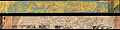
 1878 Adams Monumental Illustrated Panorama of History - Geographicus - WorldHistory-adams-1871.jpg 10,000 × 4,235; 14.71 MB
-
 1878 Andriveau-Goujon Pocket Map of Paris, France - Geographicus - Paris-andriveau-1878.jpg 6,000 × 4,532; 8.79 MB
-
_During_the_Revolutionary_War_-_Geographicus_-_NewYorkCity-johnsonbien-1878.jpg/120px-1878_Bien_and_Johnson_Map_of_New_York_City_(Manhattan_Island)_During_the_Revolutionary_War_-_Geographicus_-_NewYorkCity-johnsonbien-1878.jpg)
-
 1878 Government Land Office Map of Lanai, Hawaii - Geographicus - LanaiHawaii-lo-1878.jpg 4,000 × 3,029; 1.47 MB
-
 1878 Logerot Map of Paris, France - Geographicus - Paris-logerot-1878.jpg 6,000 × 4,099; 7.61 MB
-

-
_-_Geographicus_-_BritishIsles-migeon-1878.jpg/120px-1878_Migeon_Map_of_the_British_Isles_(_England%2C_Ireland%2C_Scotland_)_-_Geographicus_-_BritishIsles-migeon-1878.jpg)
-

-
_-_Geographicus_-_America-meiji12-1879.jpg/120px-1879_Meiji_12_Japanese_Map_of_North_America_and_South_America_(_Western_Hemisphere_)_-_Geographicus_-_America-meiji12-1879.jpg)
-
 1879 Mitchell Map of Boston, Massachusetts - Geographicus - Boston-mitchell-1879.jpg 4,000 × 2,620; 3.91 MB
-

-
 1880 Clerot Pocket Map of Paris and Environs, France - Geographicus - Paris-clerot-1880.jpg 5,904 × 4,216; 16.09 MB
-
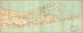
 1880 Colton Pocket Map of Long Island - Geographicus - LongIsland-colton-1880.jpg 6,000 × 2,923; 3.68 MB
-
_-_Geographicus_-_Tokyo-meiji-1880.jpg/120px-1880_Japanese_Meiji_Woodblock_Map_of_Tokyo_(EDO)_-_Geographicus_-_Tokyo-meiji-1880.jpg) 1880 Japanese Meiji Woodblock Map of Tokyo (EDO) - Geographicus - Tokyo-meiji-1880.jpg 4,000 × 2,899; 3.78 MB
1880 Japanese Meiji Woodblock Map of Tokyo (EDO) - Geographicus - Tokyo-meiji-1880.jpg 4,000 × 2,899; 3.78 MB
-
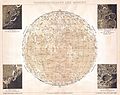
 1880 Perthes - Stieler Map of the Moon - Geographicus - Moon-stieler-1870.jpg 4,000 × 3,417; 3.22 MB
-
 1880s Meiji Japanese Folding Map of Japan - Geographicus - Japan-meiji-1880.jpg 3,580 × 5,000; 5.56 MB
-
 1881 Lefevre Pocket Map or Plan of Paris, France - Geographicus - Paris-lefevre-1881.jpg 5,000 × 3,765; 6.34 MB
-
 1881 Mitchell Map of California w- San Francisco Inset - Geographicus - CA-m-1881.jpg 2,363 × 3,500; 2.24 MB
-
 1881 Thomas Sedgwick Steele Map of Maine - Geographicus - Maine-steele-1881.jpg 3,498 × 5,000; 3.62 MB
-
 1882 Andriveau-Goujon Pocket Map of Paris, France - Geographicus - Paris-andriveau-1882.jpg 6,000 × 4,570; 10.58 MB
-

-
 1882 Mitchell Map of New York City, New York - Geographicus - NewYorkCity-mitchell-1882.jpg 4,000 × 2,611; 3.46 MB
-

-

-

-
 1883 U.S.G.S. Map of the Hawaiian Islands - Geographicus - Hawaii2-USGS-1883.jpg 4,000 × 2,727; 1,013 KB
-
 1883 U.S.G.S. Map of the Island of Hawaii - Geographicus - HawaiiHawaii2-USGS-1883.jpg 2,551 × 2,896; 1.17 MB
-
 1884 Bradley Map of Montana, Wyoming and Idaho - Geographicus - MTWYID-bradley-1884.jpg 4,000 × 2,747; 3.26 MB
-
.jpg/120px-1884_Drew_Pocket_Map_of_Florida_-_Geographicus_-_Florida-drew-1884_(cropped).jpg) 1884 Drew Pocket Map of Florida - Geographicus - Florida-drew-1884 (cropped).jpg 2,073 × 1,729; 2.42 MB
1884 Drew Pocket Map of Florida - Geographicus - Florida-drew-1884 (cropped).jpg 2,073 × 1,729; 2.42 MB
-
 1884 Drew Pocket Map of Florida - Geographicus - Florida-drew-1884.jpg 6,000 × 5,734; 9.8 MB
-
 1885 De Witt Alexander Wall Map of Maui, Hawaii - Geographicus - Maui-lo-1885.jpg 6,000 × 4,784; 6.44 MB
-
-

-

-
 1886 Lewis Map of Mobile Bay, Alabama - Geographicus - MobileBay-lewis-1880s.jpg 3,000 × 3,788; 1.72 MB
-
 1886 Meiji 19 Japanese Map of Tokyo, Japan - Geographicus - Tokyo-meiji19-1886.jpg 3,616 × 5,000; 6.92 MB
-
 1886 Telescopic View and Map of the Moon - Geographicus - Moon-unknown-1886.jpg 3,500 × 4,950; 3.27 MB
-

-

-
-
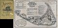 1889 Ewer Map of Nantucket, Massachusetts - Geographicus - Nantucket-ewer-1889.jpg 4,000 × 1,933; 2.35 MB
-
 1889 Vuillemin Map of Paris, France - Geographicus - Paris-vuillemin-1889.jpg 6,000 × 4,173; 8.24 MB
-
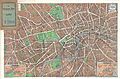
 1890 Bacon Pocket Map of Liverpool, England - Geographicus - Liverpool-bacon-1890.jpg 3,500 × 5,253; 6.21 MB
-
.jpg/120px-1890_Bacon_Traveler%27s_Pocket_Map_of_London%2C_England_-_Geographicus_-_London-bacon-1890_(cropped_to_show_St_James%27s_Gardens%2C_Camden).jpg)
-
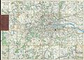
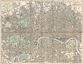 1890 Bacon Traveler's Pocket Map of London, England - Geographicus - London-bacon-1890.jpg 6,000 × 4,598; 11.4 MB
-
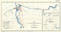
 1890 Hachette Map of Antarctica - Geographicus - Antarctica-hachette-1890.jpg 3,500 × 2,711; 2.61 MB
-

-

-
 1891 Meiji Map of Tokyo or Edo, Japan - Geographicus - Tokyo-meiji-1891.jpg 3,500 × 2,610; 2.61 MB
-

-
 1892 Hachette Plan or Pocket Map of Paris, France - Geographicus - Paris-hachette-1892.jpg 6,000 × 5,037; 27.71 MB
-

-
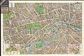
 1892 Smith's Pocket Map of London, England - Geographicus - London-smith-1892.jpg 5,000 × 3,429; 5.13 MB
-
 1892 Tourist's New Map of Scotland - Geographicus - Scotland-bartholomew-1892.jpg 3,500 × 4,567; 4.73 MB
-

-

-

-
 1894 Colton Map of Maine - Geographicus - Maine-c-1894.jpg 3,000 × 3,682; 3.71 MB
-
_-_Geographicus_-_Paris-hachette-1894.jpg/120px-1894_Hachette_Pocket_Map_of_Paris%2C_France_(shows_Eiffel_Tower)_-_Geographicus_-_Paris-hachette-1894.jpg)
-
-

-
_-_Geographicus_-_NYC-bien-1895.jpg/120px-1895_Bien_Map_of_New_York_City_(w-_Queens_%5E_the_Bronx)_-_Geographicus_-_NYC-bien-1895.jpg) 1895 Bien Map of New York City (w- Queens ^ the Bronx) - Geographicus - NYC-bien-1895.jpg 3,532 × 5,000; 3.73 MB
1895 Bien Map of New York City (w- Queens ^ the Bronx) - Geographicus - NYC-bien-1895.jpg 3,532 × 5,000; 3.73 MB
-

-
 1895 Philip Pocket Map or Plan of London, England - Geographicus - London-philip-1895.jpg 7,000 × 4,984; 13.47 MB
-
 1895 Stanford's Pocket Map of Europe - Geographicus - CentralEuorpe-stanford-1895.jpg 3,000 × 2,405; 2.37 MB
-
 1895 Times of India Map of Bombay, India - Geographicus - Bombay-times-1895.jpg 4,151 × 6,000; 6.17 MB
-

-

-
_-_Geographicus_-_YellowstoneGeo-usgs-1896.jpg/120px-1896_U.S._Geological_Survey_Geological_Map_of_Yellowstone_National_Park_(4_sheets)_-_Geographicus_-_YellowstoneGeo-usgs-1896.jpg)
-
_-_Geographicus_-_Yellowstone-usgs-1896.jpg/120px-1896_U.S._Geological_Survey_Map_of_Yellowstone_National_Park_(4_sheets)_-_Geographicus_-_Yellowstone-usgs-1896.jpg)
-

-
 1897 Walker View of Boston Harbor - Geographicus - Boston-walker-1897.jpg 3,500 × 2,432; 2.34 MB
-
 1898 Brockhaus Map of the Moon - Geographicus - Moon-brockhaus-1898.jpg 3,000 × 2,385; 1.48 MB
-

-

-
 1899 Bacon Pocket Plan or Map of London - Geographicus - London-bacon-1899.jpg 6,000 × 4,012; 10.49 MB
-
_-_Geographicus_-_NYC-HomeLife-1899.jpg/120px-1899_Home_Life_Map_of_New_York_City_(_Manhattan_and_the_Bronx_)_-_Geographicus_-_NYC-HomeLife-1899.jpg)
-

-
 1900 Bacon Pocket Map of London, England - Geographicus - London-bacon-1900.jpg 5,000 × 4,454; 8.05 MB
-
 1900 Gall and Inglis' Map of London and Environs - Geographicus - London-gallinglis-1900.jpg 6,000 × 4,904; 12.15 MB
-
_-_Geographicus_-_Paris-garnier-1900.jpg/120px-1900_Garnier_Pocket_Map_or_Plan_of_Paris%2C_France_(_Eiffel_Tower_)_-_Geographicus_-_Paris-garnier-1900.jpg)
-
_-_Geographicus_-_NouveauParisMonumental-garnier-1900.jpg/120px-1900_Garnier_Pocket_Map_or_Plan_of_Paris%2C_France_(_Eiffel_Tower_and_other_Monuments_)_-_Geographicus_-_NouveauParisMonumental-garnier-1900.jpg)
-

-

-

-

-

-

-

-
 1901 Japanese View and Map of Nikko, Japan - Geographicus - Nikko-japan-1901.jpg 4,000 × 2,872; 4.54 MB
-

-
 1902 L'Armee Case Map of Paris and Environs - Geographicus - Paris-armee-1902.jpg 6,000 × 5,078; 8.95 MB
-
_-_Geographicus_-_OhauHawaii-lo-1902.jpg/120px-1902_Land_Office_Map_of_the_Island_of_Oahu%2C_Hawaii_(_Honolulu_)_-_Geographicus_-_OhauHawaii-lo-1902.jpg)
-
-

-
 1904 Land Office Map of Niihau, Hawaii - Geographicus - Niihau-lo-1904.jpg 3,804 × 5,000; 2.66 MB
-

-
_-_Geographicus_-_Setauket-uscs-1925.jpg/120px-1904_U.S.G.S._Map_of_Long_Island_New_York_(Islip%2C_Brookhaven%2C_Smithtown)_-_Geographicus_-_Setauket-uscs-1925.jpg)
-
_-_Geographicus_-_Montauk-uscs-1925.jpg/120px-1904_U.S.G.S._Map_of_Long_Island%2C_New_York_(_Montauk_%5E_Easthampton)_-_Geographicus_-_Montauk-uscs-1925.jpg)
-

-
-
_-_Geographicus_-_NewYork-woodharmon-1906.jpg/120px-1906_Wood_Harmon_Map_of_New_York_City_(w-_Staten_Island%2C_Bronx%2C_Brooklyn_%5E_Queens)_-_Geographicus_-_NewYork-woodharmon-1906.jpg)
-

-

-

-
 1909 U.S.G.S. Geological Survey of Vancouver City - Geographicus - Vancounver-USCS-1909.jpg 2,900 × 2,189; 1.01 MB
-
_-_Geographicus_-_SinoJapanese-japan-1910.jpg/120px-1910_Atlas_of_the_Sino-Japanese_War_(25_rare_folding_maps)_-_Geographicus_-_SinoJapanese-japan-1910.jpg)
-
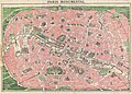
 1910 Leconte Monument Map of Paris, France - Geographicus - ParisMonumental-leconte-1910.jpg 5,000 × 3,689; 5.94 MB
-
_-_Geographicus_-_London-smith-1910.jpg/120px-1910_Smith%27s_Tape_Indicator_Map_of_London_(_Pocket_Map_)_-_Geographicus_-_London-smith-1910.jpg)
-

-
 1913 U.S.G.S. New York ^ New Jersey Atlas - Geographicus - NYAtlas-usgs-1815.jpg 1,860 × 2,082; 508 KB
-

-

-
 1920 Bacon Pocket Map of London, England and Environs - Geographicus - London-bacon-1920.jpg 5,000 × 3,651; 6.14 MB
-
_-_Geographicus_-_Paris-leconte-1820.jpg/120px-1920_Leconte_Pocket_Map_of_Paris%2C_France_(with_Eiffel_Tower_and_Metro)_-_Geographicus_-_Paris-leconte-1820.jpg)
-
 1920 Robelin Map of Paris, France - Geographicus - Paris-robelin-1920.jpg 5,000 × 3,749; 14.88 MB
-
 1920s Bartholomew Fire Brigade Map of London, England - Geographicus - London-bartholomew.jpg 9,000 × 6,715; 20.89 MB
-

-

-

-

-
-
 1924 Geographia Pictorial Map of London, England - Geographicus - London-geographia-1924.jpg 5,000 × 3,350; 6.89 MB
-
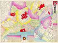
%2C_China_-_Geographicus_-_Beijing-crow-1925.jpg/120px-1925_Crow_Plan_of_Beijing_(Peking)%2C_China_-_Geographicus_-_Beijing-crow-1925.jpg) 1925 Crow Plan of Beijing (Peking), China - Geographicus - Beijing-crow-1925.jpg 3,000 × 3,144; 1.43 MB
1925 Crow Plan of Beijing (Peking), China - Geographicus - Beijing-crow-1925.jpg 3,000 × 3,144; 1.43 MB
-
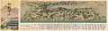
 1925 Taisho 14 Japanese Panoramic Map of Nikko - Geographicus - Nikko-taisho14-1925.jpg 3,500 × 1,299; 836 KB
-

-
-

-

-
_-_Geographicus_-_Kyoto4Maps2-yoshida-1928.jpg/120px-1928_Showa_3_Hiroshi_Yoshida_Railroad_Map_of_Kyoto%2C_Japan_(4_Maps)_-_Geographicus_-_Kyoto4Maps2-yoshida-1928.jpg)
-

-
 1929 Folk Art Manuscript Map of Kentucky - Geographicus - Kentucky-fws-1929.jpg 6,000 × 2,892; 2.79 MB
-
-
%2C_China_-_Geographicus_-_Tienjien-nikkodo-1930.jpg/120px-1930_Nikkodo_Map_of_Tienjien_(_Tientsin%2C_Tianjin)%2C_China_-_Geographicus_-_Tienjien-nikkodo-1930.jpg)
-

-

-

-

-
 1931 WenYi Map of SooChow or Suzhou, China - Geographicus - SooChow-wenyi-1931.jpg 4,000 × 3,021; 2.85 MB
-

-
%2C_China_-_Geographicus_-_Tienjin-showa7-1932.jpg/120px-1932_Chinese_Map_of_Tientsin_(Tianjin_or_Tienjin)%2C_China_-_Geographicus_-_Tienjin-showa7-1932.jpg)
-
 1932 Hochi Map of Shanghai, China - Geographicus - Shanghai-hochi-1932.jpg 3,000 × 2,003; 1.22 MB
-

-

-

-
-

-

-
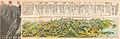
 1936 Korea Panoramic Map of Railway - Geographicus.jpg 3,183 × 837; 778 KB
-
 1936 Showa 11 Japanese Topographic Map of Kyoto, Japan - Geographicus - Kyoto-showa11-1936.jpg 6,000 × 4,193; 10.88 MB
-
 1936 Showa 11 Panoramic Map View of Korea - Geographicus - KoreaPanorama-showa11-1936.jpg 4,000 × 1,180; 1.46 MB
-
_-_Geographicus_-_Shanghai-uk-1932.jpg/120px-1937_World_War_II_Japanese_Map_of_Shanghai%2C_China_(w-photo_of_Bund)_-_Geographicus_-_Shanghai-uk-1932.jpg)
-
 1938 Pictorial Map of Washington D.C. - Geographicus - WashingtonDC-traster-1938.jpg 5,000 × 2,830; 4.91 MB
-
 1939 Japanese World War II Chart or Map of Hawaii - Geographicus - Hawaii-japanese-1939.jpg 6,000 × 4,093; 4.21 MB
-
 1939 Le Petit Parisien Map of the Eastern Hemisphere.jpg 4,000 × 2,795; 2.48 MB
-
 1939 Map of the World at the Beginning of World War II.jpg 4,000 × 2,764; 2.44 MB
-


_-_Geographicus_-_NewYork-uscs-1874.jpg)


_-_Geographicus_-_SavannahCarleston-uscs-1874.jpg)
_-_Geographicus_-_LakeChamplain2-uscs-1874.jpg)


,_China_-_Geographicus_-_Taiwan-imray-1876.jpg)


_-_Geographicus_-_BritishIsles-migeon-1878.jpg)

_-_Geographicus_-_America-meiji12-1879.jpg)


_-_Geographicus_-_Tokyo-meiji-1880.jpg)


.jpg)


.jpg)


_-_Geographicus_-_Paris-hachette-1894.jpg)


_-_Geographicus_-_NYC-bien-1895.jpg)


_-_Geographicus_-_YellowstoneGeo-usgs-1896.jpg)
_-_Geographicus_-_Yellowstone-usgs-1896.jpg)


_-_Geographicus_-_NYC-HomeLife-1899.jpg)


_-_Geographicus_-_Paris-garnier-1900.jpg)
_-_Geographicus_-_NouveauParisMonumental-garnier-1900.jpg)


_-_Geographicus_-_OhauHawaii-lo-1902.jpg)


_-_Geographicus_-_Setauket-uscs-1925.jpg)
_-_Geographicus_-_Montauk-uscs-1925.jpg)

_-_Geographicus_-_NewYork-woodharmon-1906.jpg)


_-_Geographicus_-_SinoJapanese-japan-1910.jpg)

_-_Geographicus_-_London-smith-1910.jpg)


_-_Geographicus_-_Paris-leconte-1820.jpg)


,_China_-_Geographicus_-_Beijing-crow-1925.jpg)


_-_Geographicus_-_Kyoto4Maps2-yoshida-1928.jpg)


,_China_-_Geographicus_-_Tienjien-nikkodo-1930.jpg)


,_China_-_Geographicus_-_Tienjin-showa7-1932.jpg)


_-_Geographicus_-_Shanghai-uk-1932.jpg)


_During_the_Revolutionary_War_-_Geographicus_-_NewYorkCity-johnsonbien-1878.jpg)